Sunset Goes South: Part Two
The cold front came and the temp dropped. We woke up to 30 degrees on November 11, but the wind had dropped as expected meaning that we had the green light to sail for Norfolk, Virginia which lies about 120 nautical miles to the Southwest of Ocean City, Maryland. After radioing the Coast Guard to get some local knowledge on the time of current change at the inlet, we took on fuel and departed the dock at 10:35am. It was much calmer exiting the Ocean City Inlet and the current was close to slack, but no dolphin guiding us out the inlet this time around. We motor-sailed with the jib until the wind died and continued by diesel power making 5.5 to 6 knots.
The ocean was full of dolphin that day and a couple daring souls seemed to be playing chicken with the boat, surfacing 100 feet ahead of the bow, headed towards the boat, and close enough to see their smiling faces. The boat danced along the ocean and we made great time through the day, so I estimated we would be at the mouth of the Cheseapeake Bay at 3:00am on November 12. With 35 degree air temp, it would be the kind of sailing night that you pile on all the layers you packed. That night we were finally rewarded with a spectacular sunset at sea which was much needed after the trying first leg of the trip. Under starry skies we continued in calm seas taking three hour shifts through the night. At this point in the trip, most of my crew had to return to NYC, so it was only Rebecca and I trading shifts for this long leg of the journey. It's a totally different ballgame sailing at night under the stars compared to cloudy, rainy, stormy weather. Rather than being glued to the compass as your only sense of direction, the stars guide your way and give you points to focus on, the way early travelers would have navigated before modern navigation tools.

Sunset at sea en route to Norfolk, VA from Ocean City, MD.
At 4:25am on November 12, we passed the Chesapeake Bay Bridge Tunnel. The Chesapeake Bay is a remarkably large bay and sailing through it really puts that into perspective. Looking at a chart, it looks almost as if a large chunk of the East Coast landmass is missing. That's the Chesapeake Bay. Full of large ships from overseas, cruise ships, tugs and barges, pilot boats, and fishing boats. In addition to navigating through the channels, my head was on a swivel looking out for fast-approaching vessels. After a couple hours, we turned into the Elizabeth River which runs along the West side of Norfolk. Now we were officially in the Intracoastal Waterway - otherwise known as the ICW - which is an 1,100 mile watery highway connecting Norfolk, VA and Miami, FL via a series of rivers, canals, bays, and sounds. A truly amazing part of the country only seen by boat!

The Naval base at Norfolk, VA.

Entering the ICW at Norfolk, VA.

Going through one of the locks in the ICW with about 20 other vessels.
During my charting and planning, I figured we would stop in Norfolk, VA for the day to rest after the overnight trip from Ocean City, MD, however, the great weather and progress made energized us and we decided to continue south through the ICW for the rest of the day. We navigated through the ICW until 4pm and dropped anchor near the number "95" day beacon in the North Landing River. That evening, clouds and light rain started to move in, but the weather called for the rain to stop by 11:00am the next day. We decided we would get a late start the next day and wait for the rain to slow before we made our way to the town of Manteo on Roanoke Island in the Outerbanks.

The "anchor dram" at the number "95" day beacon.
Many sailing voyages ago, Scandinavians coined the term "anchor dram" - a drink had after reaching your destination and setting anchor - and I learned this tradition from Captain Pat during one of our Bahamas sailing adventures. After the 30-hour voyage from Ocean City, MD to the number "95" day beacon, I figured we earned ourselves an anchor dram. My typical anchor dram is a shot of aged rum, as I've heard a shot of rum a day at sea keeps the sea gods pleased.
The next morning we made a hearty breakfast, pulled the anchor up at 10:30am, and we were underway to Roanoke Island. The rain let up by 11:00am as expected and we started to dry out. We pushed through the day motor-sailing with the jib as we knew it would be a race against the sun to get into the channel and harbor at Manteo that night. We sailed through the Albemarle Sound towards Roanoke, turned Northeast towards Manteo with strong winds across the beam. We flew the last few miles to Manteo just as the sun was starting to go down. Rebecca's friends, Scot and Kristen, were there waiting for us and guided us to one of the free dock slips in town. You can tie up for a night or two at the free dock slips before having someone from the town kick you out.
Manteo is a very cool town with lots of interesting history. Highly recommended to visit by sea or land. That night we visited a couple local watering holes, tried our hand at trivia, wandered through the town, and made our way back to the boat to rest for the next day's travel.
I plotted a course for New Bern, NC, found a marina there to keep Sunset for two weeks while I fly back to NY to pickup my lovely girlfriend from the airport and drive to upstate NY for Thanksgiving, and booked flights from New Bern to NYC. This meant I was on a time crunch to get settled in New Bern to catch my flight, so unfortunately there wouldn't be much time to spend in Manteo exploring. The trip to New Bern was a two day trip through the Pamlico Sound - a massive body of water separating mainland North Carolina from the Outerbanks - and I scouted a protected anchorage in Wysocking Bay to spend the night.
We left Manteo after stocking some provisions, fueled up at Pirate's Cove Marina on Roanoke Island, snaked our way through a channel towards the Pamlico Sound, and entered the sound with 20 - 25 knots of wind out of the Northwest. The Pamlico Sound is so large that it has it's own NOAA weather report for wave heights and winds. We motorsailed with strong winds and 2 to 4 foot waves across the beam and starboard quarter making for the occasional spray into the cockpit as the waves crashed against the hull. Luckily we had sunshine to provide some warmth that day. Making great time, and out of sight from land for most of the day, we covered 40 nautical miles after a busy morning of errands and a fuel run. We entered Wysocking Bay as the sun was going down - seemingly a common theme now to make it to a berth or anchorage at dusk - and tucked the boat close to land as protection from the wind and waves, with the last bits of sunlight, some well-lit navigation aids, and Sunset's deck lights guiding our way.
The next leg to New Bern, NC would be considerably longer, approximately 70 nautical miles from Wysocking Bay, so I planned our departure for 5:00am the next day. Even with a full set of sails, which we didn't have at the time, 70 nautical miles would take 10 hours with the 15 - 20 knots of wind in the forecast. I estimated a 12 hour journey and expected to arrive at dusk, once again. Awake at 4:30am, breakfast, and anchor up shortly after 5:00am, we left Wysocking Bay with beautiful starry skies and a shooting star streaking across the sky just minutes after pulling up the anchor, guiding us back into the Pamlico Sound.

Sunrise in the Pamlico Sound en route to New Bern, NC.
With similar conditions to the prior day, but slightly diminished winds and seas, the ride was a bit more dry and slightly more comfortable. We sailed Southwest for most of the day completely out of sight of land through the giant Pamlico Sound, towards the Neuse River, and New Bern. Like clockwork, we arrived at the marina in New Bern at dusk, tucked the boat in, and went out to explore the town of New Bern.
I fell for New Bern's charm, it's friendly atmosphere, delicious seafood, history, and convenience. With the boat docked at the Galley Stores & Marina, it was a short walk to the town's center full of good restaurants, shops, and historic sites, including the birthplace of Pepsi at Brachman's Pharmacy. It's a bit out of the way for most boaters traveling through the ICW and added about 20 nautical miles each way to the total trip length, but well worth the extra travel if you have a few days to relax and explore.

Sunset tucked away at the marina in New Bern.

The New Bern City Hall.

Bear Alley in the town center.
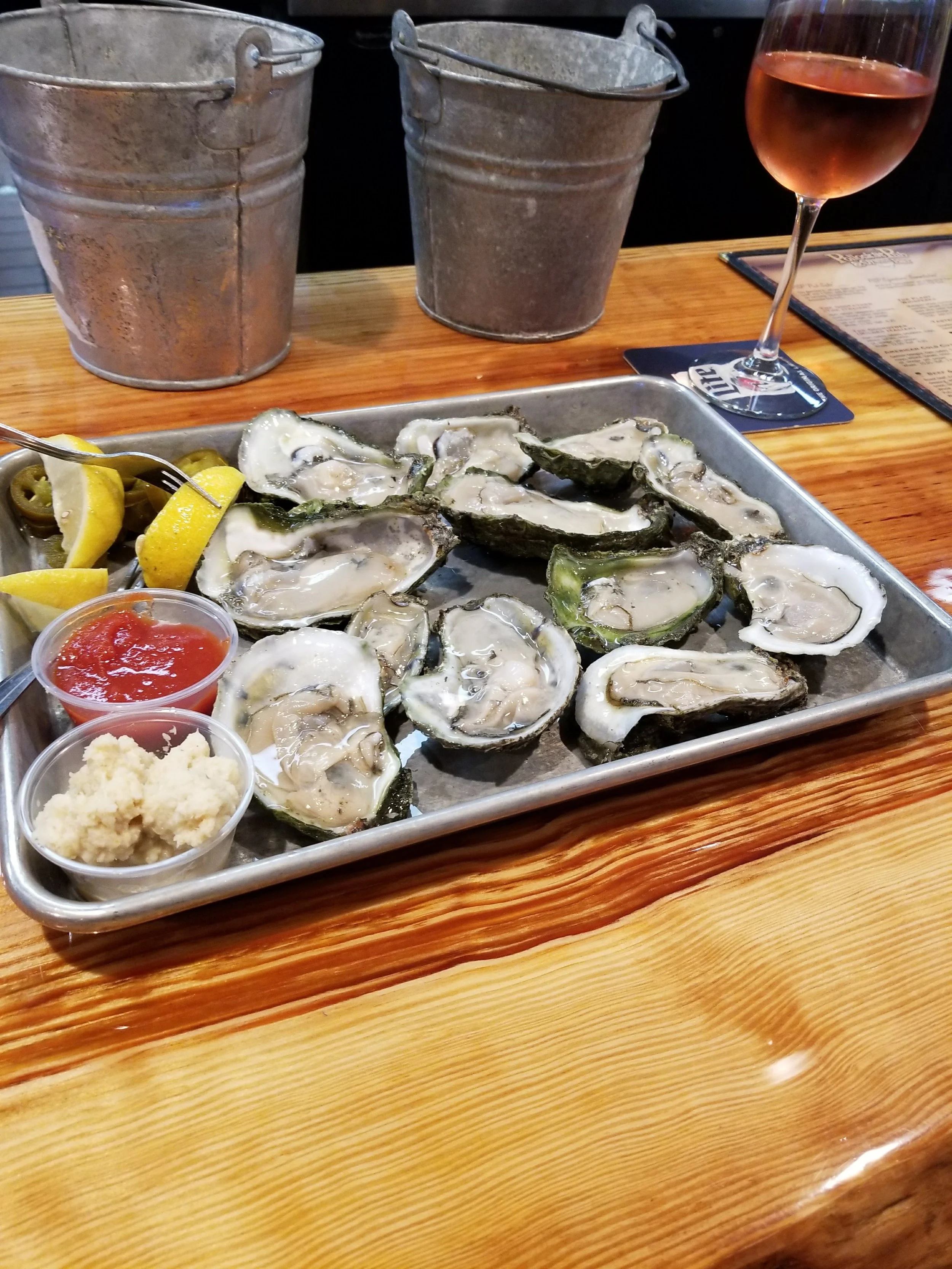
Delicious local oysters from Topsail Island, NC. I couldn't pass up fresh local oysters!
After 495 nautical miles traveled, an exciting first leg, exploring the ICW, and dozens of dolphin sightings, it's time to fly to NY. Next up: a new set of sails and 220 ocean miles with my brother! Part three coming soon.
- Captain James